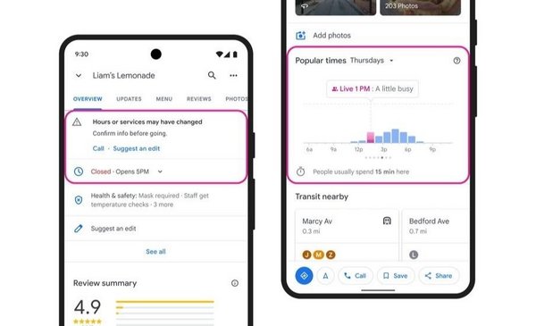
Google Maps will be updated, thanks to artificial intelligence (AI) and a machine learning model, storage hours and old speed limitsEspecially in the wake of the Covid-19 pandemic.
Companies have seen many changes “in recent years”, including constantly updating working hours based on restrictions to deal with the coronavirus crisis.
to be updated, Google Maps has developed an automatic learning model that identifies business hours that have not been updatedas he explains on his blog.
The AI updates them with its predictions, which are based on a series of parameters, which the technology explains with the example of a lemonade shop. for a start, Their systems take into account multiple factors such as when the business file is updated, nearby store opening hours, and busy times.
Then Google’s algorithms analyze the opening hours of the nearest similar stores (other lemonade stores), information on their website (if they have one) and even Street View mode, based on storefront images, to determine the most accurate prediction for their day.
At the same time, Google takes into account feedback from the map community, From local directories to business owners themselves through their Google Business profile to check out what to expect.
In Argentina, Australia, Chile, France, Japan, Mexico, New Zealand, Peru and the United States, the company will also call businesses directly to confirm their hours of operation directly using Google Duplex chat technology. Artificial intelligence that allows you to make calls instead of the user with a human voice and as an assistant.
Google’s goal is to update the working hours of more than 20 million companies around the world In the next six months.
Maps will also update the old speed limits
Google also announced that it will begin updating information about speed limits, starting with the United States. To do this, the company will partner with other companies that have already collected road images to improve their delivery methods.
Then, Google will use a combination of artificial intelligence and help from its operations teams to identify a marker in the image, extract new speed limit information, and update maps.
Taking into account privacy
The company ensures that all new features and updates are implemented with “privacy consideration”. in this way, Google only uses photos taken on public roads.
The tech company claims that it is also asking its partners to obfuscate information, such as faces and license plates, to prevent someone from being identified.. For an extra layer of privacy, Google blurs the image again when it’s received and deletes it once it’s used to update its maps.
Europa Press

“Wannabe internet buff. Future teen idol. Hardcore zombie guru. Gamer. Avid creator. Entrepreneur. Bacon ninja.”


